Millennium Project
Colin Cohen
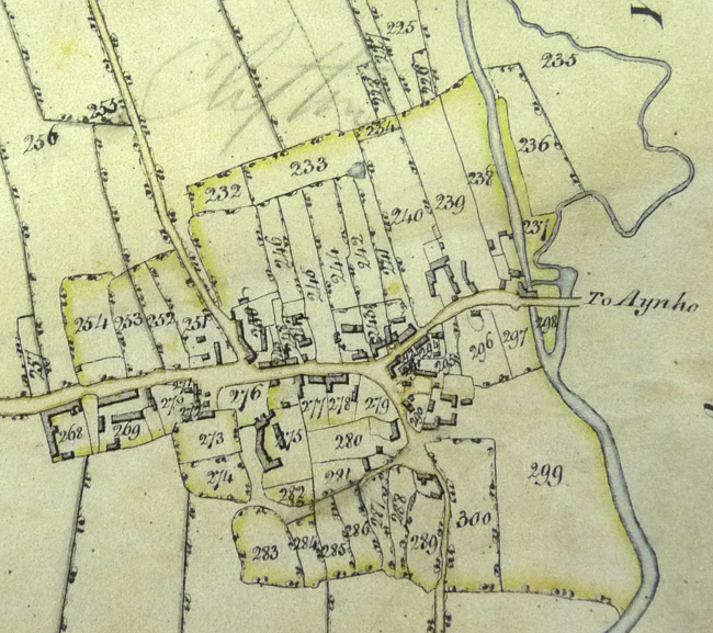
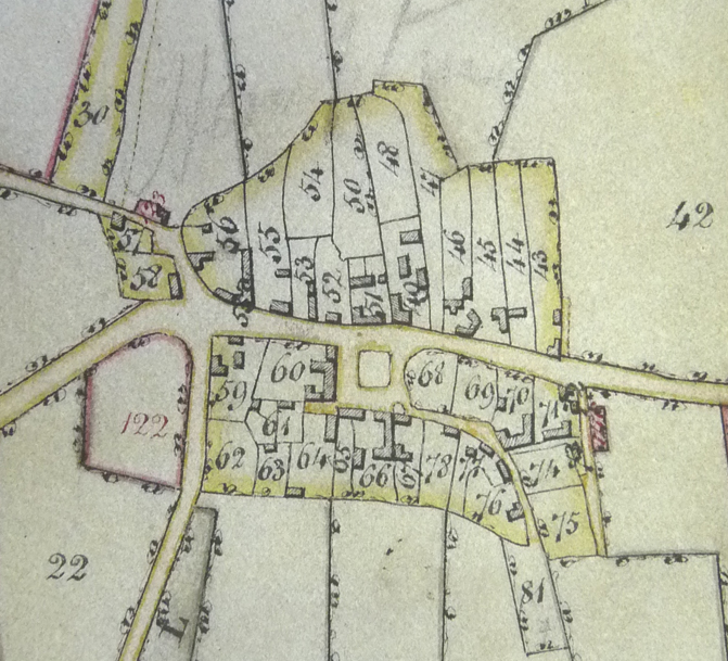
The 'Plan of Deddington Town' [MS. Don. b. 36. ƒ67v] reproduced below is from the Cartwright family Duchy Manor records and shows their holdings in the town. You can view a pdf (1.2Mb) image of the original list by clicking here or a transcription by clicking here. The numbers are part of wider survey of the whole Parish of Deddington and thus are not in continuous numerical order. There are some thirty holdings at a scale of approximately three chains to the inch [1:2,376 in new money, I think]. You will see from the list that there are maps for the Hamlets of Hempton [ƒ79v] showing the green, and Clifton [ƒ73v], both at a similar scale and also of individual fields within the Duchy Manor. The Duchy versions of Hempton and Clifton are not available here but those from the County Survey (with acknowledgement to Oxford Records Office) below contain the same key numbers:
|
|
Hempton |
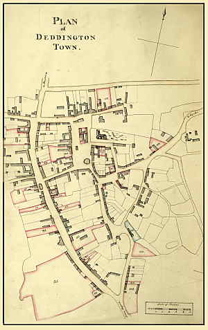
Street names are not shown on the face of the map, but some of the allotments give a street, so it is possible to note some changes when compared to the current OS atlas. I had a quick drive round to see if atlas and signs differed.
The first name in each case is the name given in the table facing the map, where one is given. New Street and Earls Lane are listed and it it no surprise that they are as today.
121 = Church Lane [now Church Street], corner with Chapel Square
126 = Castle End [now Castle Street officially]
106 = near the market cross [now Market Street officially, but the sign says Place]
143 = Sattin Lane [actually in what is now St Thomas Street]
130a = Philcott Street [on corner with Chapel Square]
73 = Market Street [now Market Place officially]
105 = Market Street [now Market Place officially, on the corner facing the Bullring]
25 = a messuage called the Croach [site south of what is now Deddington Manor, about 5 acres, though the table only shows it as 2 rods]. The present owner of the house in New Street, known as the Manor, has never heard the term and it is not in any online dictionary or even in the full OED. Google finds a few references as a rare family name. it has been suggested that it might be an abbreviation of 'encroachment', in this case representing land taken into an estate. However it is not listed on ƒ 81 [a list of incroachments].
A further suggestion is that if the piece of ground was crooked, it could be a corruption of 'croche' (as in shepherd's crook), but the plot if fairly regular in this case, so we remain at a loss. By one of those strange co-incidences in 1808 it was let with cottage 19 in New Street to a John Whetton. Today it is the Old Bakehouse.
By 1885 the first edition of the six-inch Ordnance Survey map shows that the Croach and land about 450 feet further south to a point opposite Satin Lane and the track to Leadenporch Farm were part of the Manor gardens.
Names can be put to the other holdings using this town plan or the larger Enclosure map.
The tables facing the maps in no case take up more than the facing page, with details of Manor Court hearings [except in the case of the townships, where only details of the initial tenants and the field areas are shown]. Entries peter out during the nineteenth century and the last one seems to be a lease of 1880 to Ibells for an allotment of about 14 acres. The assumption of an assured future for the Duchy Manor can be gauged by the number of blank pages left between each map and table - ten in each case - for new tenants.
The volume measures 425 x 267 mm, a size known as Large Post.
Reproduced by permission of The Bodleian Library, University of Oxford and Ooxford Records Office